Earth’s ecosystems and biogeochemical cycles drive and respond to environmental change; and environmental changes are occurring at an unprecedented rate. MSU Texas geoscientists and environmental scientists develop tools and models to understand, detect, predict, and model interactions within and between ecosystems, the atmosphere and the critical zone across scales that range from local to global.
We are modelers and remote sensing experts with both hydrogeology and terrestrial carbon cycle background. We apply a diversity of approaches for the characterization of complex environmental systems. We perform intensive research and analyze information about the complex hydrogeological behavior of aquifers including heterogeneity, uncertainty, connectivity, flow, and transport processes. We are also interested to understand the response of the carbon cycle and terrestrial ecosystems to climate and environmental changes.
We use ground based remote sensing data to map earth surface features to characterize its properties or understand the changes in ecosystems, hydrology, forestry, and so on. The work would address scientific questions using remote sensing data targeting the dynamics of earth systems due to unexpected disturbances or gradual changes. Moreover, we focus on solving various challenges in remote sensing data by applying stochastic image analysis and geostatistical methods. Our analyses use data from field survey, terrestrial remote sensing, drone-based imaging, satellite remote sensing networks and national spatial data infrastructures - all areas of innovation for our researchers.
RSM Lab has a terrestrial LiDAR instrument called Leica BLK360 G2 for accurate three-dimensional mapping. This instrument can be used in a wide range of land management and planning efforts, including geologic mapping, forestry, agriculture, hazard assessment, and watershed and river surveys. LiDAR can also be used in any situation where the structure and shape of Earth’s surface needs to be known.
RSM Lab has 10 pieces of Stalagmate driplogger Mk3c with USB data cable and Gemini Explorer software. These drip loggers are self-contained battery-powered box slightly larger than 5cm cube that record drips automatically, typically from stalactites which are cave ceiling features. These are new drip logger product ideal for cost-effective way to automatically count water drops to generate high temporal resolution and continuous drip discharge time series for up to 4 years. Now caves offer a natural inception point to observe both the long-term groundwater recharge and the preferential movement of water through the unsaturated zone of fractured bedrock by monitoring cave drip rates. And to detect the groundwater movement and quantify recharge is critical for understanding the water cycle and contaminant transport, and for water management.
Students learn the basics of surveying using level, staff, and measuring tape. The lab has four Nikon levels with custom Forestry Supply metric staffs and 30 m tapes.
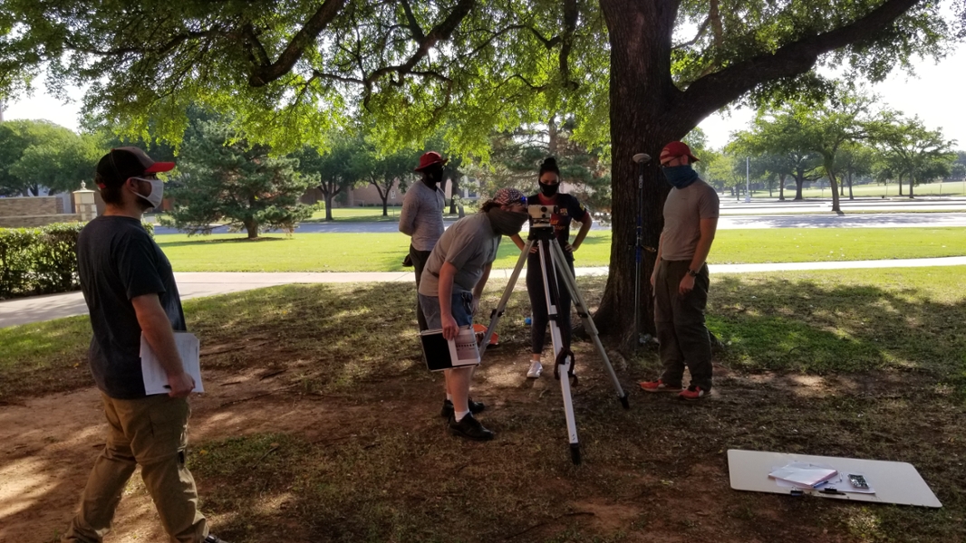
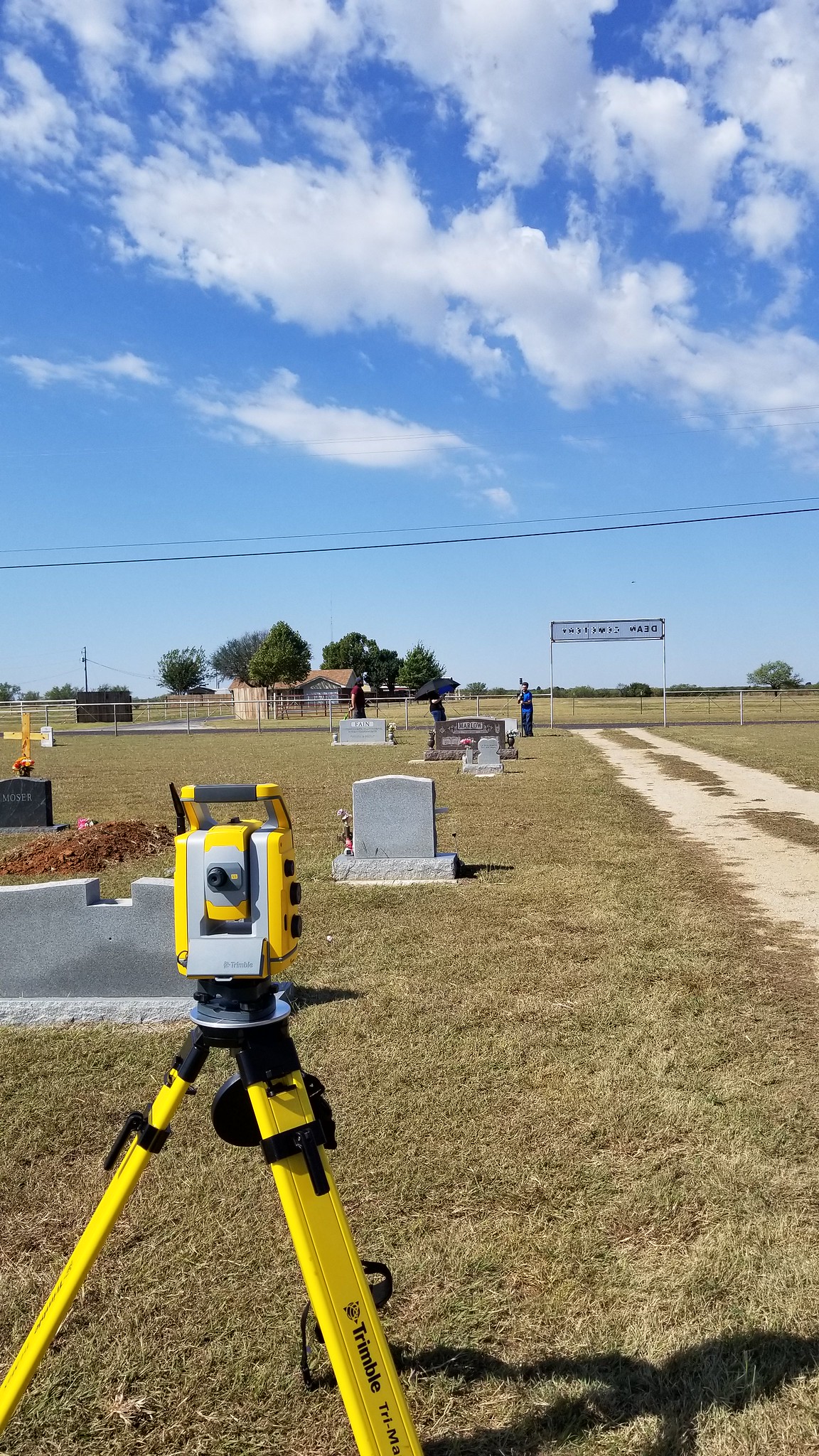
The lab maintains a Trimble S5 robotic electronic transit theodolite and electronic distance meter, with TSC7 Win10 controller. The instrument is able to automatically follow a single operator with an adjustable-height prism for 100+ m. This survey tool can construct cm-scale maps on a relative or absolute scale. The total station is relatively portable, with an anti-shock case that can be worn as a backpack. Data can be offloaded directly or through Trimble connect on the internet.
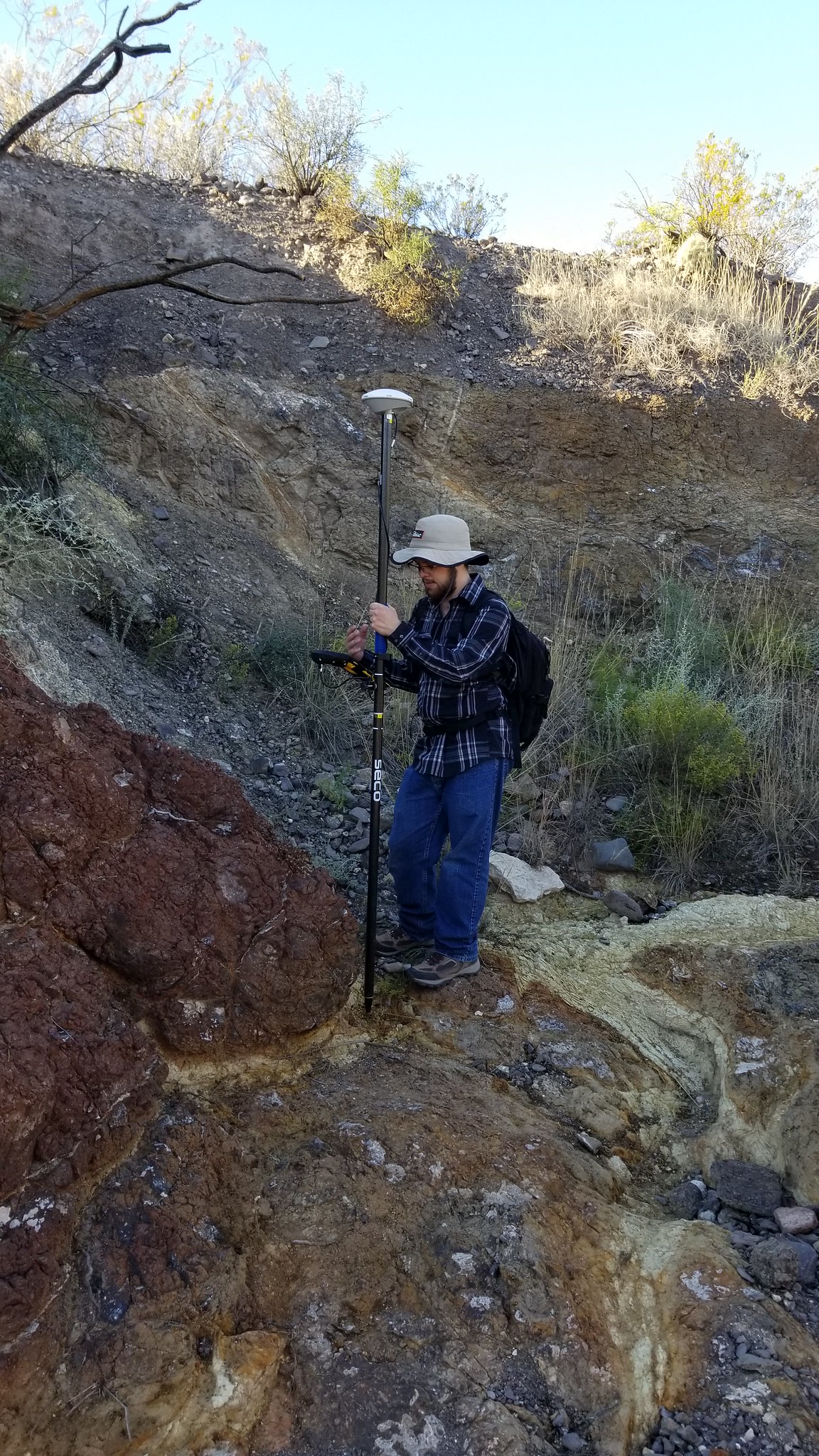
The lab contains a Trimble TDC-150 GPS GNSS Handheld Data Collector and Zephyr antenna. The TDC is an Android OS device with SIM card. The device provides a survey of absolute position. With an unobstructed view of overhead satellites, these yield decimeter resolution in X and Y, and 2 m resolution in Z, and decimeter resolution in Z when connected to the internet. Data acquisition is synced to Trimble Connect for offloading.
The Kimbell School of Geosciences has a Educational Academic Departmental Medium Term Concurrent Use License with SRI. Students can create individual ArcGIS Pro accounts and use the software for digitizing geospatial measurements, geologic mapping, and cross-correlation with other GIS and subsurface mapping software. Data from the TSC7 and TDC 150 can be directly imported into the ArcGIS Pro.
MSU Texas has Academic MATLAB licenses for students’ use. This is a proprietary multi-paradigm programming language and numeric computing environment developed by MathWorks. The students can use the software to create scientific graphics, to perform mathematical calculations, and to analyze scientific data including geoscience and environmental science data.
The Remote Sensing and Modeling (RSM) Lab is managed by Dr. Kashif Mahmud